hill country home
watercolor concept sketch of a hill country residence
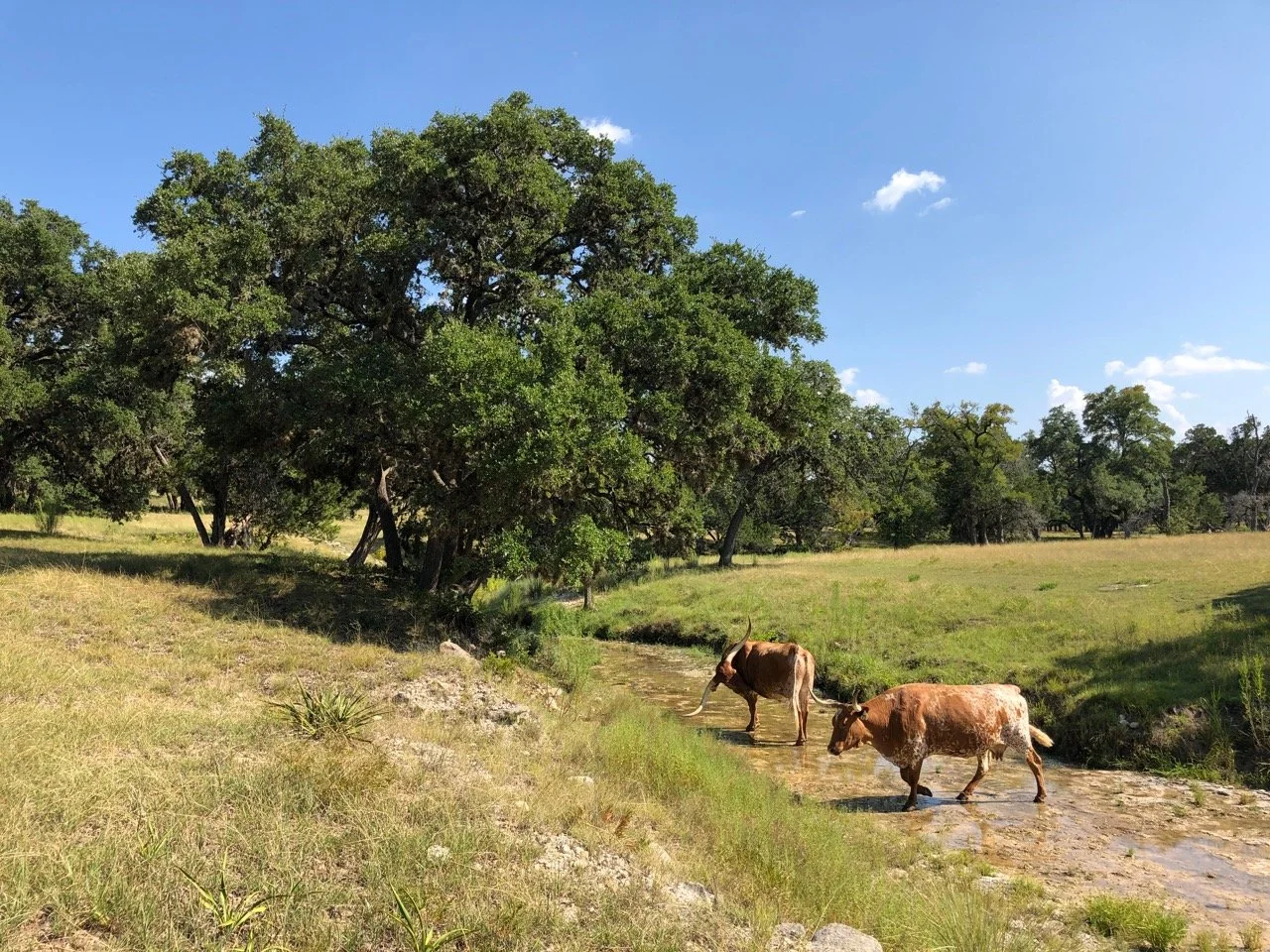
In 2023, we began construction on a 7-acre property at the Preserve at Walnut Springs in the rural lands outside Johnson City. The landscape provides a bigger canvas for gardening, family life and animals - the Preserve hosts a herd of longhorn, horses and wildlife.
Our design process began with a site analysis that would help shape the future build: landscape, trees and topography, view corridors, water and power source, wind direction, solar orientation, and historical context. With these valuable observations we can create informed site plans, building models and sketches.
LANDSCAPE PAINTINGS AND SKETCHES
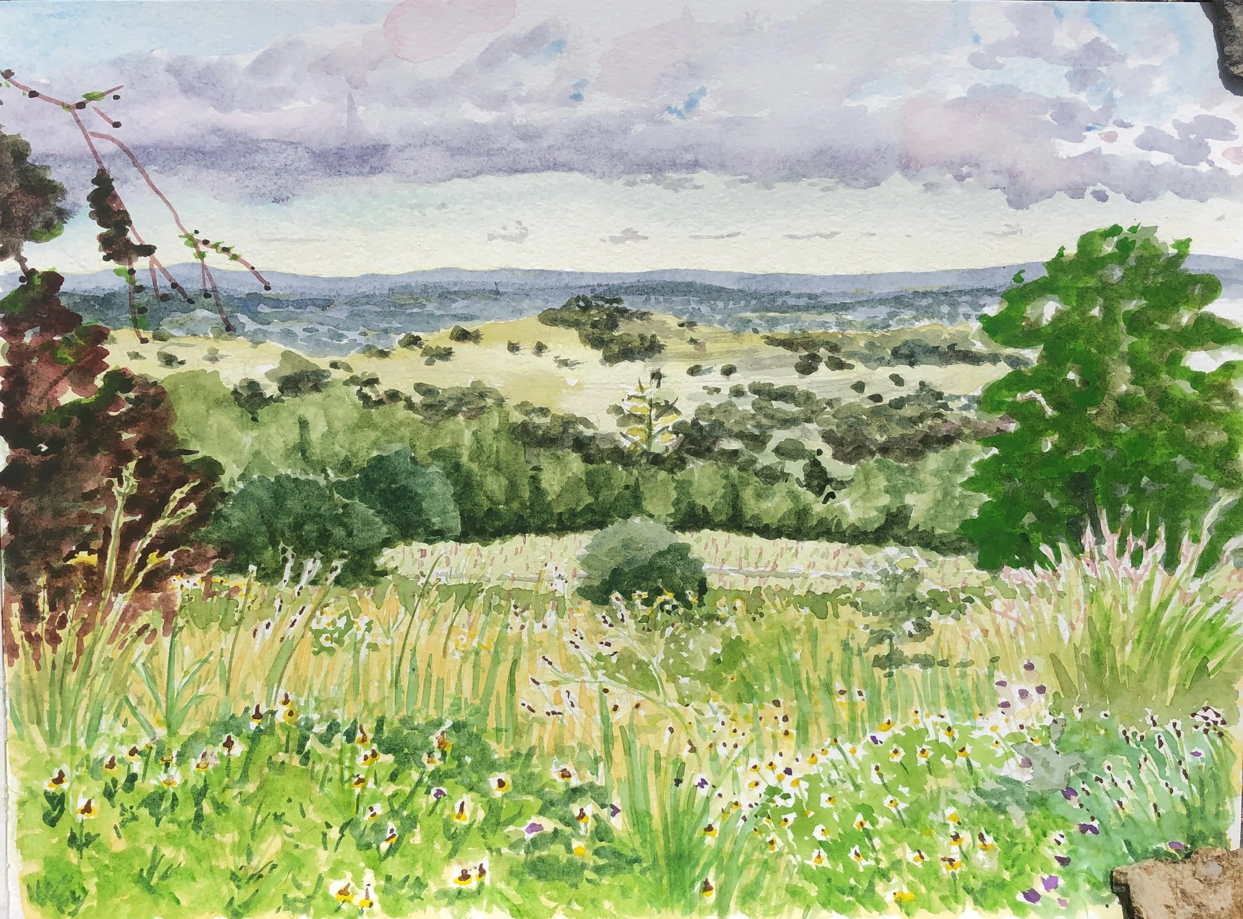
We gain a general impression of the landscape through plein air watercolor, which is the best way to discover the color spectrum on a site and views across the land. This plein air watercolor captures the oak trees clumped like cotton balls across the landscape of Walnut Springs. The sun casts long shadows in early morning or late evening, so views looking northwest or southeast at a hillside will make for a dynamic composition.
TREES & TOPOGRAPHY
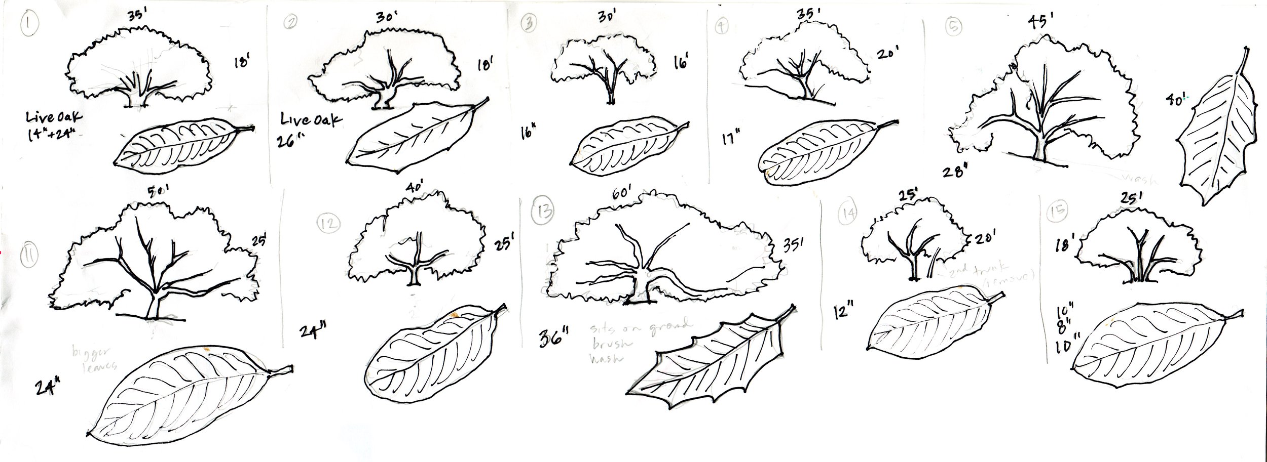
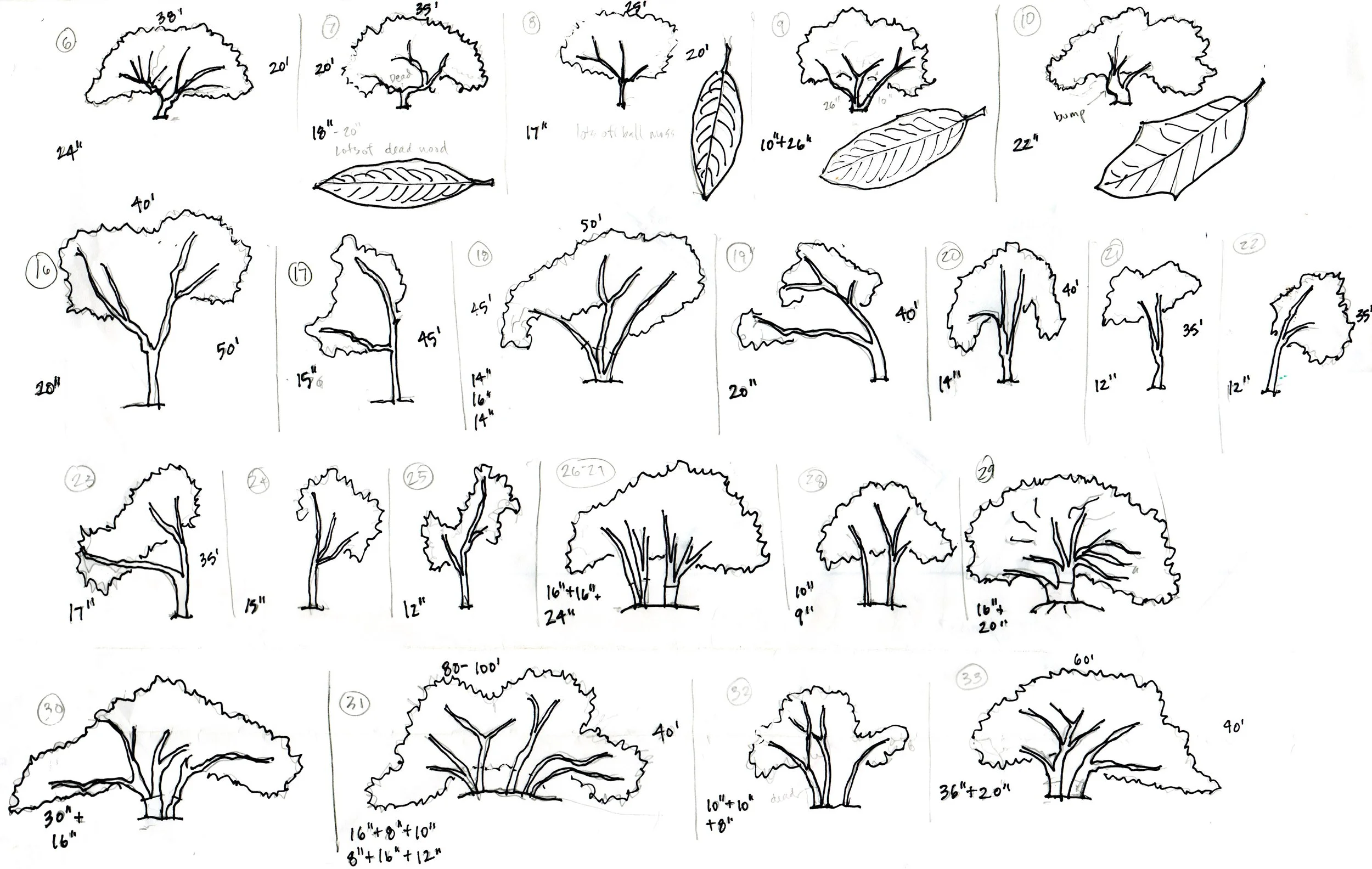
One of the first priorities in our site analysis is tree documentation and health. We consult with Heritage Tree Care to review not only the health of the mature trees but native plants, erosion patterns, groundwater and soil observations and a maintenance plan. Live oaks are beautiful but they are currently a mono-culture on many hill country sites. It’s important to plan for tree diversity by introducing new native species that will thrive along with the oaks and promote wildlife diversity.
Surveyors will provide tree and topography (slope) information, but when possible we like to measured document each tree ourselves. It’s important to be aware of the shape of each tree, since critical limbs can extend surprisingly far in one direction and sometimes vertically. Cindy sketched and documented the trees on our site:
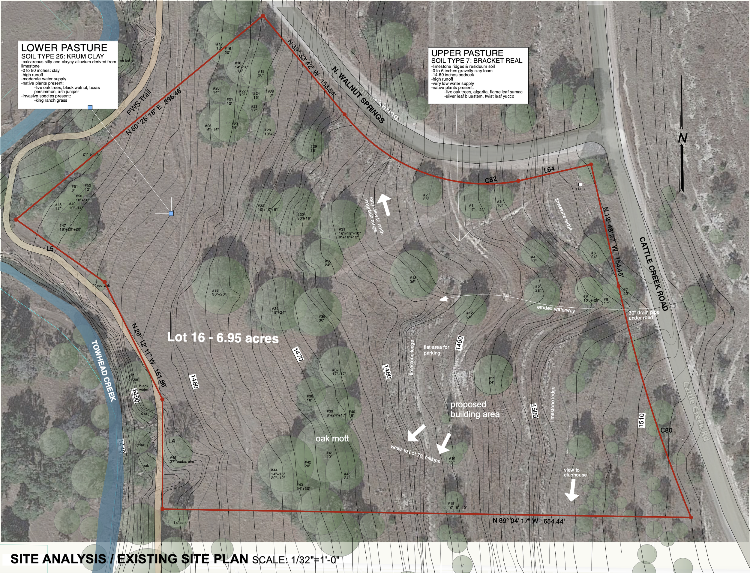
After these initial drawings and extensive walks on the site, we create an existing site plan. Texas A&M Forestry mapping services provides aerial maps with nice contrast between ground and tree, which allows for the most accurate canopy documentation. It also provides 50-foot contours, flood zone and watershed information. We can cross reference that with USGS topographical map data which provides 2-foot contours of any site.
Landscape planning and foundation engineering will be well served by understanding the soil composition. Typically the Hill Country is composed of Bracket real (limestone shelf), but often the soil changes near creek beds. This data is mapped on USDA Natural Resources Conservation Site / Web Soil Survey.
WATER AND POWER SOURCE
Blanco and Gillespie counties are served by the Ellenberger-San Saba aquifer. Historically many ranches relied on well water, but it is more common now to install rainwater catchment systems for higher quality drinking water. However, rainfall is an obvious concern. The LCRA Hydromet shows rainfall data, stream flow, and soil moisture all along the Colorado River basin in Texas.
Even when water is scarce, there are effective means of capturing rainwater. Placement and sizing of the rain tank and catchment system is a critical part of the site design. We consulted with Innovative Water Solutions provides rainwater consulting for the Hill Country, and researched erosion control and rainwater harvesting that we will integrate with the landscape design. Our site is near the dam that holds water along Towhead Creek, which is a beautiful feature to discover after a hike down our small trail system.
Cindy & Nancy
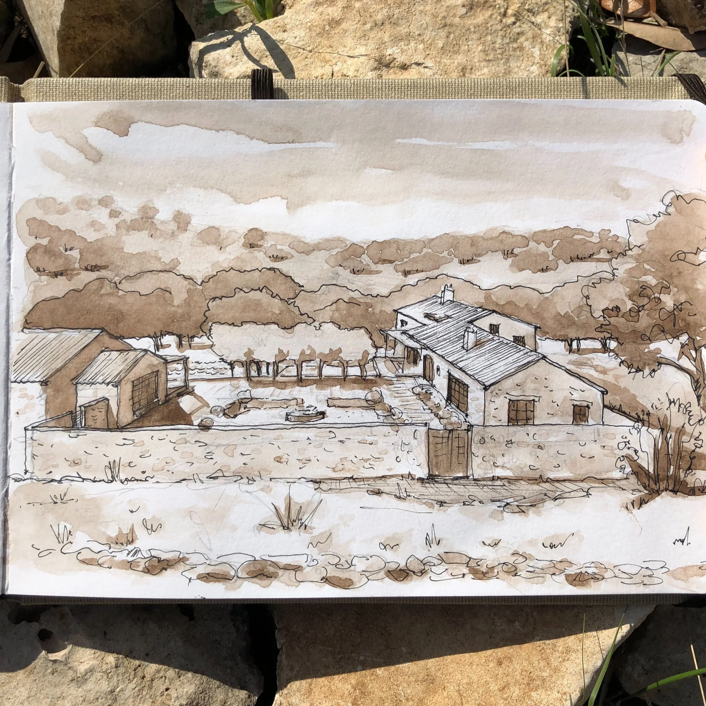
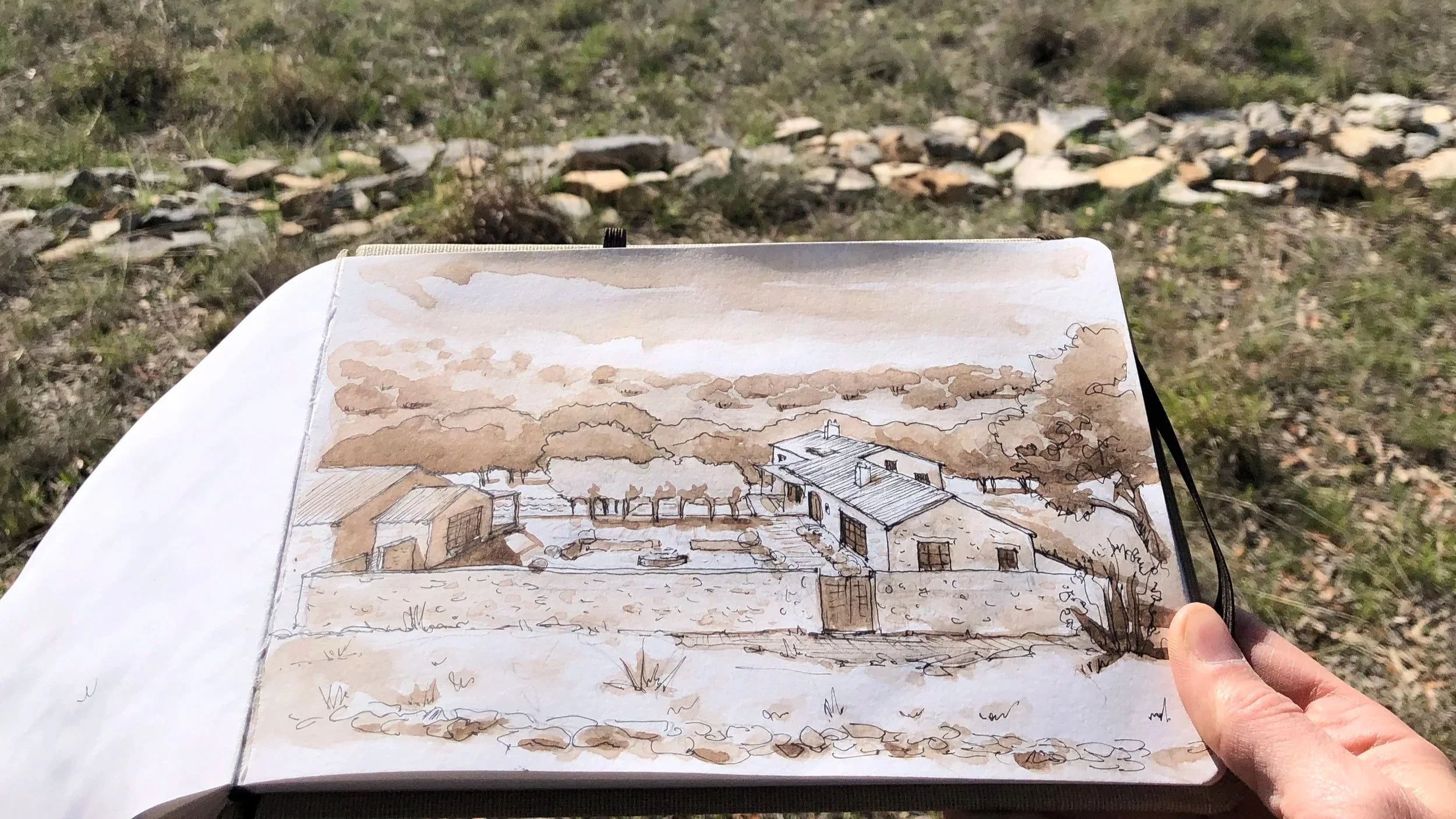
SCHEMATIC SITE PLAN
The drawing below was created to explore the approach to the site, outdoor spaces, building scale, roof design and rainwater collection. The pathway upon arrival, or being able to see a car coming, is fun to think about. The forms of the building, garden walls and terraces are shaped to frame the view. The building is sited within proximity to mature trees to benefit from shade but not feel crowded.

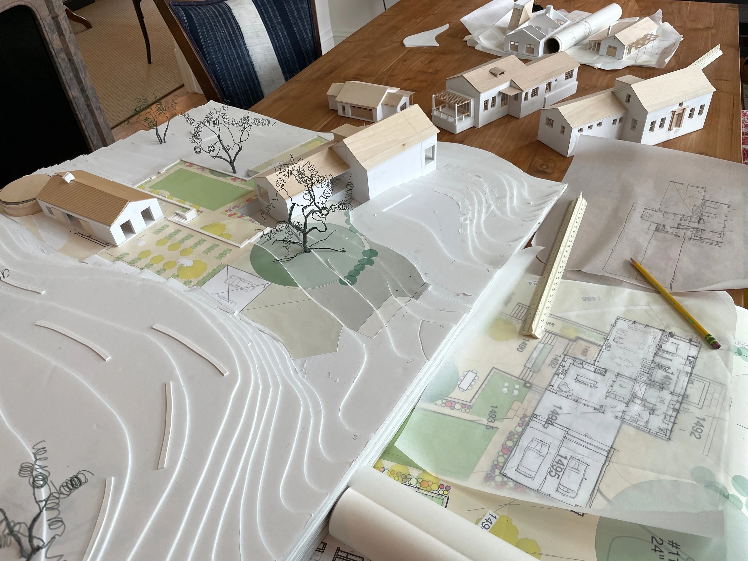
MODELS
With the site plan and floor plan in development, we build scale models to allow us to explore the three dimensional aspects of design: scale and shape of the roof, openings and light exposure, the way the building fits within the contours of the site. Sometimes this comes with surprises, such as how many steps it can take to get down to the next level. We changed the design completely after this scheme - the building height was growing too tall out of grade when oriented across the contours.
HISTORICAL CONTEXT
What is the look and feel of the place? This is a big question as we develop the character of the building and make decisions about roof pitch, window proportions, and materiality. We love the old stone buildings in Blanco and Gillespie County, characterized by the historic German heritage of Fredericksburg. We committed early on to building out of stone, and staying true to the visual language of masonry structures.
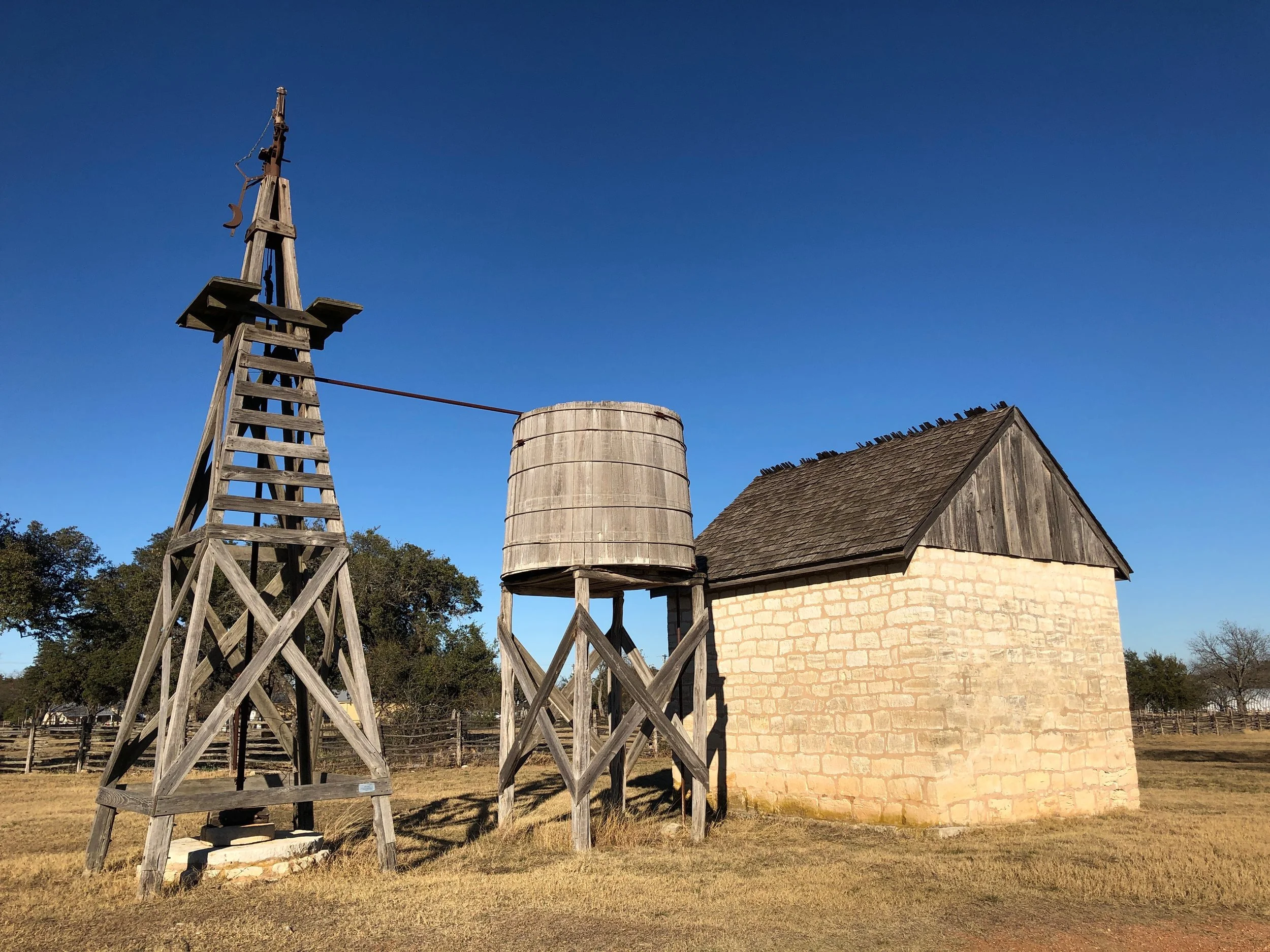
Windmill, cistern and granary at LBJ Settlement Ranch, Johnson City
ARCHITECTURE
The vision of the place comes together slowly, awkwardly and with a lot of discarded ideas. However, some ideas stay in place from beginning to end - these are the things we know to be crucial to the place and guide our decision making. From the sketch below, we established a few critical concepts: the house is a simple, gable roof box; the view to the hills should be framed by the architecture; a stone wall or enclosure will define the garden; buildings will relate to each other across this garden.